Projects
Creation of transport and passenger transport interchange nodes at the point where route networks of St. Petersburg and Leningrad region
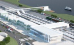
Transport interchange hub "Devyatkino"
Development of ground railway transport, linking central districts of St. Petersburg with new areas of urban agglomeration

Construction of the “St. Petersburg – Sertolovo” light rail transit line

Construction of the “St. Petersburg – Vsevolozhsk” light rail transit line

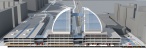
Transport interchange hub "Rybatskoye"

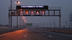
Use of photo and video recording systems and cameras to monitor traffic flows
Transport interchange hub "Kudrovo"

The organization of suburban passenger rail service on a section Sertolovo (Leningrad region) - railway station Levashovo - St. Petersburg (Finland Station)
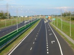
The latitudinal highway of high-speed traffic with a bridge across the river Neva in the alignment of st. Fayansovaya - st. Zolnaya (4, 5 stage)

The integration of existing and prospective automated traffic control systems in the territory of St. Petersburg and Leningrad Region

The creation of the St. Petersburg unified transport control center
Prospekt Kultury at the section from the 8th Verkhny Pereylok to the 9th Verkhny Pereylok

Preparation of a concept for development of the state budgetary institution of
the Leningrad Region “Center for Road Safety"
Highway along the Ring Road from Shosseynaya st. (road St. Petersburg - Zaporizhzhye - Priozersk) to prospective interchange with the Ring Road (in alignment with Grazhdansky pr.)
Driver's Information System at the connections to St. Petersburg Ring road

Development of a location scheme of emergency landing sites for aircraft in St. Petersburg and territories of the Leningrad Region adjacent to the borders of St. Petersburg

Development of a draft of methodological recommendations for conduct by regions of the state control in the field of traffic management

Development of a concept for the use of geolocation data and data from cellular operators to increase efficiency of passenger transport in the St. Petersburg metropolitan area

Development of a concept for creation of a test ground for intelligent transport systems

Designing a feasibility study of locating a road alignment of a new road from the federal highway A181 “Scandinavia” to the “Brusnichnoye” border crossing point

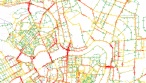
Creation of an integrated transport model of St. Petersburg and Leningrad Region
Creation of a hardware and software complex “Unified Transport Model of St. Petersburg and the Leningrad Region”
Construction of the entrance from Ring Road A-118 to the A-180 Narva highway
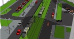
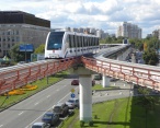
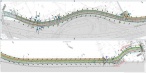
Construction of a tram line from Ulitsa Dybenko metro station to the City of Kudrovo in the Leningrad Region
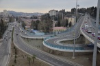
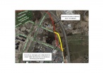
Connection of the transport interchange hub "Devyatkino" to the city road network and the St. Petersburg Ringroad

Concept of introduction of passenger electric motor vessels at the water routes of St. Petersburg
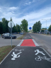
Adaptation of new approaches to develop cycling and cycling routes between Russia and Finland to improve safety, mobility and environment, and to promote social development (the case: Svetogorsk – Imatra cycle track) (KS1133 Cycling)

“Improvement of mobility, traffic safety and environmental protection by planning
Saimaa Canal bypass road to BCP "Brusnichnoye"